XAG® P150 Max
Smart, Efficient, Always Reliable
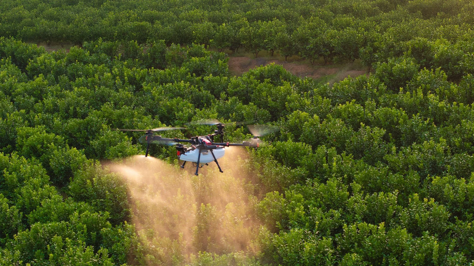
The XAG P150 Max is a state-of-the-art agricultural drone designed for superior efficiency in field operations. It handles autonomous spraying, spreading, field mapping, and material transport, with a top flight speed of 20 m/s and an 80 kg payload. Built for the most demanding conditions, it delivers leading performance, advanced intelligence, and proven reliability.
Performance That Leads
Industry-leading specifications for the most demanding agricultural operations
Payload Capacity
Maximum lifting capacity
Flight Speed
Top operation speed
Mapping/Flight
Field mapping per flight
Smart Liquid Tank
Spraying capacity
Max Flow Rate
Four-nozzle output
Granule Container
Spreading capacity
Max Spread Rate
Granule output
Rapid Charging
With parallel charging
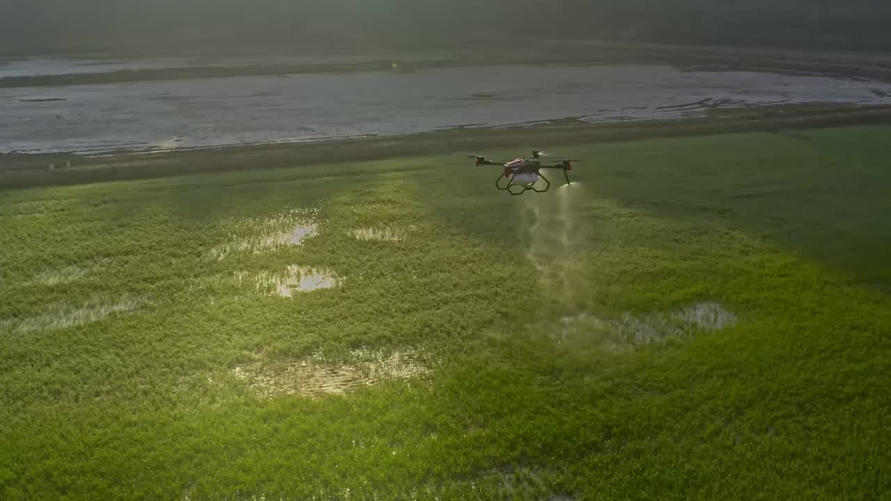
XAG RevoSpray5
High Capacity, Minimal Waste
Equipped with an 80-liter tank and capable of speeds up to 20 m/s, the P150 Max sets a new standard for precise and efficient spraying. With greater coverage per flight and fewer refills, it enhances productivity in large-field operations. The four-rotor design generates a powerful downdraft that drives droplets through dense canopies for uniform coverage.
- Flexible Impeller Pumps
Each pump delivers maximum flow of 16 L/min with chemical-resistant impeller, extending service life to over 300 hours
- Intelligent Centrifugal Nozzle
High-performance motor and spray discs produce fine, atomized droplets for uniform coverage
- Smart Liquid Tank
Capillary pneumatic design liquid level sensor for accurate chemical volume detection
- Quick-Filling Design
Nested caps enable faster, more convenient refilling between flights
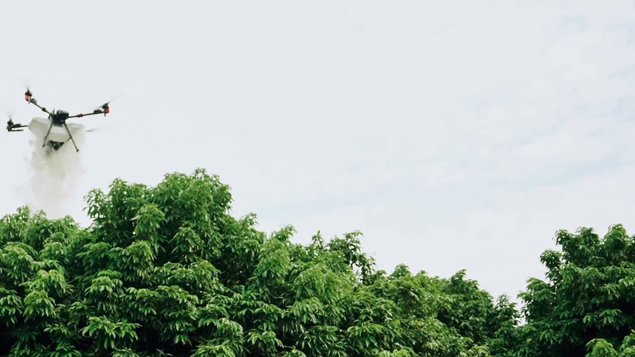
XAG RevoCast 5
Evenly Spread in Every Pass
With a 115 L granule container and an 80 kg payload, the P150 Max can spread granules at up to 300 kg/min, covering more ground with fewer stops. Its screw feeders handle a wide range of materials, from seeds to fertilizers up to 10 mm in size.
- Vertical Waving Spreader
Generates powerful downward force for improved wind resistance; direct-drive motor enhances transmission efficiency
- Three Screw Feeder Types
Large, medium, and small feeders for fertilizer spreading, direct seeding, aquaculture feeding, and powder scattering
- Smart Granule Container
Aerodynamically optimized cover reduces energy consumption; dual-side feeding simplifies operation
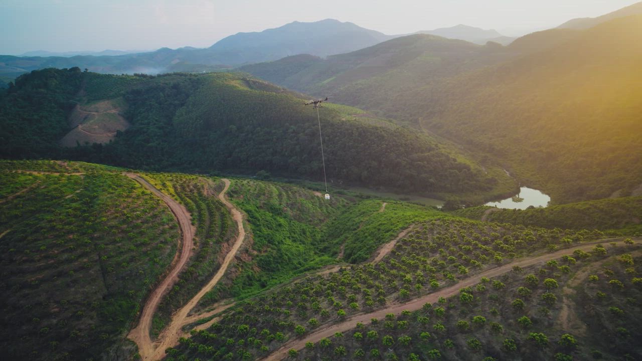
XAG RevoSling
Conquer Heavy Loads with Ease
Adding the new RevoSling module transforms the P150 Max into a versatile solution for field logistics. It can carry farm inputs, produce, and more, up to 80 kg, across plains, hills, and mountainous terrain safely and efficiently.
Payload Capacity
Max Flight Speed
- Security Lock
Sling load remains securely locked, maintaining stable balance; automatic release delivers cargo accurately
- Smooth Remote Control
SRC 5 Remote Controller with XLink HD video transmission, ultra-wide FPV view, AR overlays
- A/B Route
Set points A and B for automatic routes on flat terrain or record custom tracks for hilly areas
- Live In-Flight Weighing
Provides real-time load measurements for operator awareness during transport
Onboard XAG RealTerra
Field Mapping Built Right In
With no extra modules required, the P150 Max captures high-definition images during fully autonomous flights, even over rugged terrain. Images are automatically stitched into detailed field maps that are ready for export after landing. Built-in AI identifies obstacles such as power poles and wires.
Up to 20 Hectares per Flight
One flight surveys up to 20 hectares of farmland for comprehensive mapping
Automatic Obstacle Detection
Identify obstacles automatically for better path planning and safer operations
3D Model Preview
Generate 3D terrain models for mountain and hilly terrain visualization
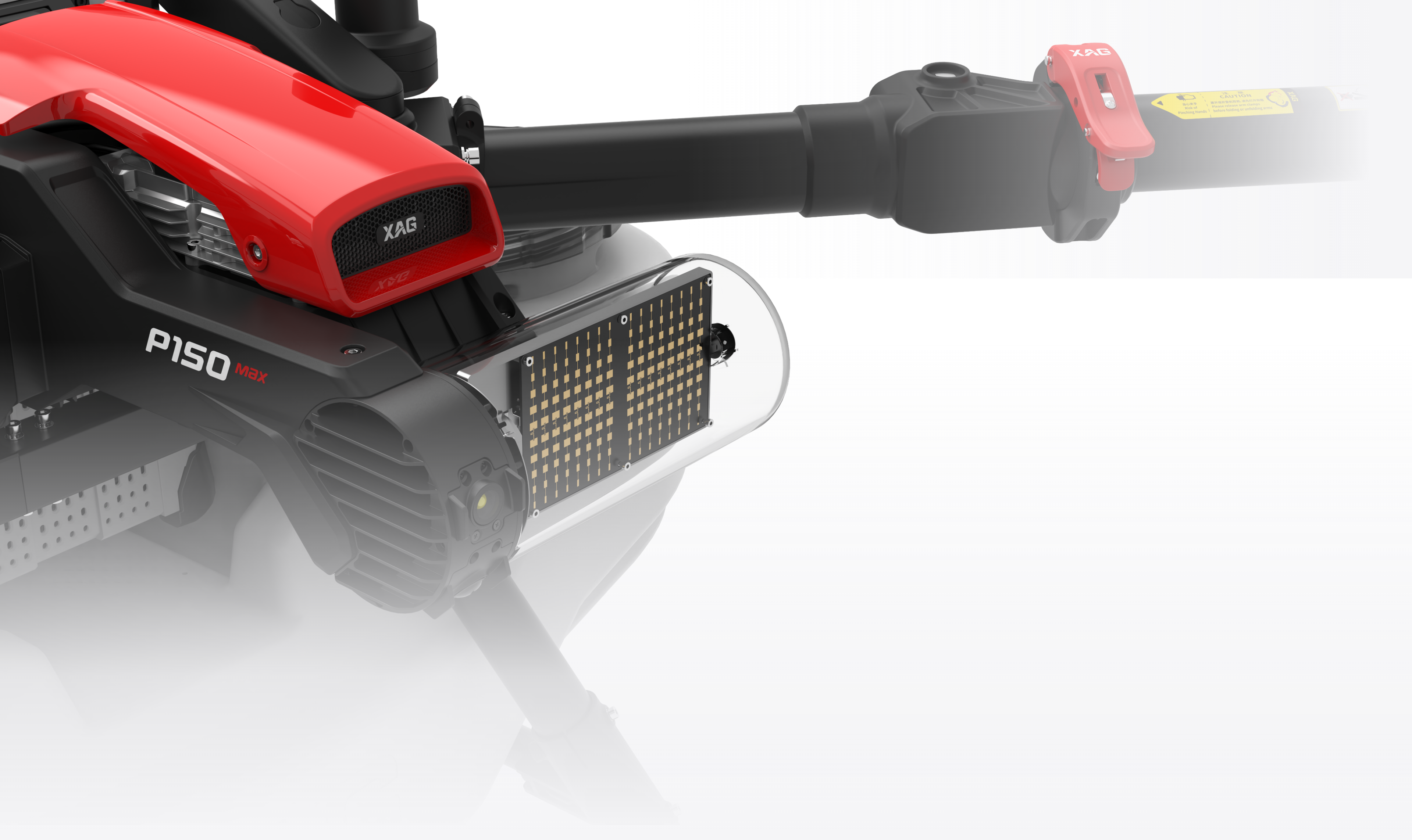
XAG SuperX 5 Ultra
The Super Brain That Thinks Ahead
Powerful processors and advanced control algorithms allow the P150 Max to perform fully autonomous operations, tackling even the most demanding tasks with precision and reliability.
Obstacle Avoidance
4D imaging radar detects obstacles 1.5 to 100 meters away. Safely avoids power poles, wires, and central pivots. Day and night operation without relying on ambient light.
Map-Free 3D Flight Mode
Fully autonomous terrain following over rugged fields and mountainous orchards. No pre-flight mapping required. Unmapped areas converted to actionable 3D maps in real time.
20 m/s Full Speed Operation
Maintain smooth flight while spraying or spreading across sloped farmland. Uninterrupted and efficient application at maximum speed.
PPP-AR Positioning Mode
Powered by GNSS satellites, achieves centimeter-level positioning without ground base stations. RTK-level accuracy with simpler setup and minimal equipment.
AI Smart Assistance
Wide-angle FPV camera with AR overlays. Real-time 3D markers for obstacles and distances. Automatic hovering when anomalies detected.
Built to Last
The robust industrial design features a low-drag airframe that reduces energy use while enhancing performance. Optimized materials provide strength and durability, ensuring reliable operation, easier maintenance, and effortless transport.
Modular Design
Flight platform and task modules are detachable, allowing quick swaps between spraying, spreading, mapping, and logistics
High-Performance Propellers
63-inch design with strength and heat resistance for powerful lift and significant load capacity
Foldable Components
Foldable arms and propellers reduce storage space for convenient transport and handling
IPX6K Water Protection
Allows safe water washing to remove pesticide residues after operations
XAG One 7.0
Autonomous Operation at Your Fingertips
Complete drone management from planning to execution, available on Android and iOS
Intelligent Route Planning
Generate optimal routes based on field shape. Automatic RTH on low liquid or power. Spiral route operation follows outside-in pattern.
In and Out Routes
Safety Point Mode maintains safe operation along fixed flight paths. Safety Zone Mode for efficient entry/exit with manually defined zones.
Multi-Field Operation
Plan continuous missions across up to 10 fields with customizable parameters for each field.
Field Mapping Modes
Support on-screen point marking, drone mapping, and survey instruments. Automatically convert flight paths into map boundaries.
Swarm Operation
Autonomous control of two drones simultaneously. Enables concurrent work and boosts operational efficiency.
Variable-Rate Application
Using prescription maps, adjusts application rates in-flight. Compatible with VRA maps from PIX4Dfields.
Teamwork
Multiple users can collaborate by sharing field maps and operational records. All data synchronized with XAG One Management Platform.
Compatible with Android and iOS
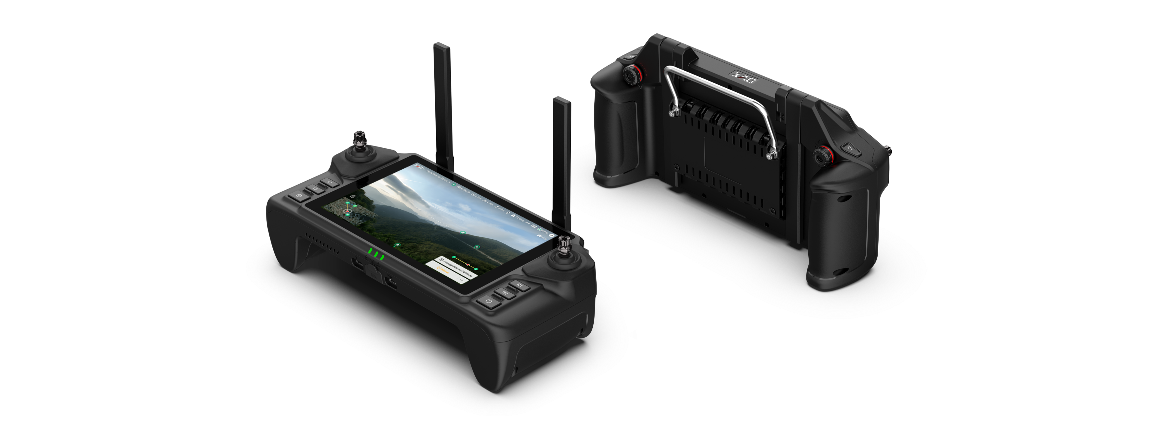
XAG SRC 5
Easy-to-Use, Fully in Control
Comfortable to hold with responsive joystick and intuitive buttons
High-brightness display stays clear in direct sunlight
Ensure uninterrupted, worry-free operation throughout the day
Virtual gimbal allows 90° real-time view adjustment
Stable, smooth video feed with transmission range up to 2 km
AR overlays show flight status for effortless manual control
No Network? We've Got Options
Centimeter-level positioning remains achievable even without internet access. Use the XRTK 7 Mobile Station for stable RTK autonomous operation, or switch to satellite-based PPP-AR mode for the same accuracy with quick setup.
XAG One App 7.0 + SRC 5 Remote Controller
XRTK 7 Mobile Station + SRC 5 Remote Controller
SRC 5 Remote Controller under PPP-AR Mode
XAG XRTK 7 Mobile Station
Precision at Your Service
- Portable RTK Station
Activate base station mode with one press for precise positioning and navigation
- Field Circling and Marking
One operator marks the field while another pilots drone, streamlining workflow and saving time
- Extend Communication Range
Maintain reliable operation in tall crops and hilly terrain without signal loss

Rapid Charging, Less Downtime
Two battery sets keep operations running continuously, even in the hottest summer.
B141050 Smart SuperCharge Battery
Compact but Powerful
Multiple Charging Solutions
XAG Battery Cooling Tower
Ultra-fine droplets evaporate instantly for exceptional cooling performance
6-8 hours uninterrupted operationCM13600S Charger
3.4 KW power output, supports parallel use for 6.8 KW output
Fully charge in ~12 minutesXAG Parallel Charging Kit
6.8 KW parallel charging for maximum efficiency
Charge in just 7 minutesGC4000+ Auto SuperCharge Station
Compact and portable with outstanding fuel efficiency and multiple protections
Display working duration & fuel timeThe P150 Max supports spraying and spreading with just one battery. For small-scale operations, two batteries are all that's required, lowering the entry barrier and reducing operating costs.
Setup in 4 Easy Steps
Quick Device Binding
Simple tap-based pairing process
Easy Field Planning
Multiple mapping methods available
One-Click Operation
Fully autonomous flight execution
Smart Return Home
Auto return at preset thresholds
XAG One App Features
Portrait & Landscape Switching
FPV full-screen display for ultra-large field of view. Easier flight with remote controller.
Immersive Maps
Full-screen map display for comprehensive field overview and precise planning.
Dark Mode
For night-time outdoor operation. Screen changes to dark mode for eye-friendly, comfortable viewing.
Key Operations More Distinct
Common functions displayed at central positions. Eliminates the need for search.
Flexible Multi-Mode Switching
Choose from Autonomous, Manual, AB Point, and more to handle complex scenarios.
Ready to Maximize Your Farm's Potential?
Contact our team to learn more about the P150 Max and how it can transform your agricultural operations.